Deutsch Italiano |
|
Espa�ol Fran�ais |
||||||

The territory
(by Gianluigi Bacchetta)
![]()
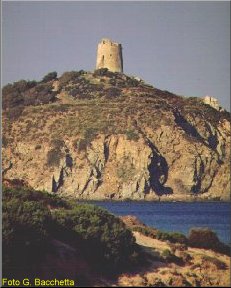
Pula and the Southern Coast are found in the South West region of Sardinia, more precisely in the Sulcis area which extends from Punta Zavorra, the Western limit of the Golfo degli Angeli, to Cape Teulada.
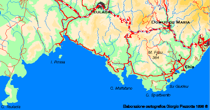
Map of the Southern Coast
From a landscape point of view, one can distinguish two types of coast: the first, which developes in a SW direction frm the Marturedda promontory to Cape Spartivento, is characterized by fairly flat areas, greatly employed under agriculture and tourism. The second, instead, extending to Cape Teulada, presents a more jagged coastline, a harsher profile, less agriculture and tourism, but more sheep-goat breeding.
|
|
Who travels the State highway Sulcitana (SS 195), towards Teulada, will no doubt be fascinated by the rapid and continuous changing of the countryside, of the geological formations and the vegetation.
The alluvial plain of Pula is a continuous following of old-fashioned farm lands - dominated by centuries-old olive trees, almond orchards and pastures shaded by cork trees and modern areas under intensive cultivation, producing prized early fruits such as tomatoes or crunchy grapes. Nearer the sea, the irrigated farmlands and the old cultivations, give place to the swamps of the lagoon of Nora and the fishery.
|
|
Proceeding towards the village of Santa Margherita, the coast maintains a low level. The greenhouse cultivations gradually give way to woods of maritime pines, stretching for more than 6 kms and first planted during the Fascist period.
In the second stretch of coast, begins the zone of Bithia. Except for the farmlands and tourist establishments in the Chia area and Su Planu Spartivento, the countryside becomes wilder, the agricultural zones diminish and the land is left to raising animals. In this area, the flat morphology is restricted almost exclusively, by the swamps behind the beaches of Chia, Stangioni de su Sali, Piscinn� and by the fisheries of Cape Malfatano and Teulada. To find any flat land, one must arrive at the Plain of San Isidoro and the zone of Tuerra, situated beyond the built-up area of Teulada, towards Sant Anna Arresi.

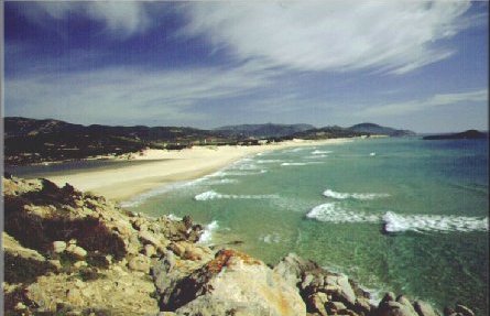
Sand dunes of Chia
The part of the coast stretching from Porto Tramatzu to Cape Teulada, is certainly the most stimulating, for its cordons of dunes and the white limestone cliffs of the cape, but it is difficult to reach because of the lack of a coastal road and the limitations due to the military poligono of Teulada.
translated by Helen Finlayson
![]()